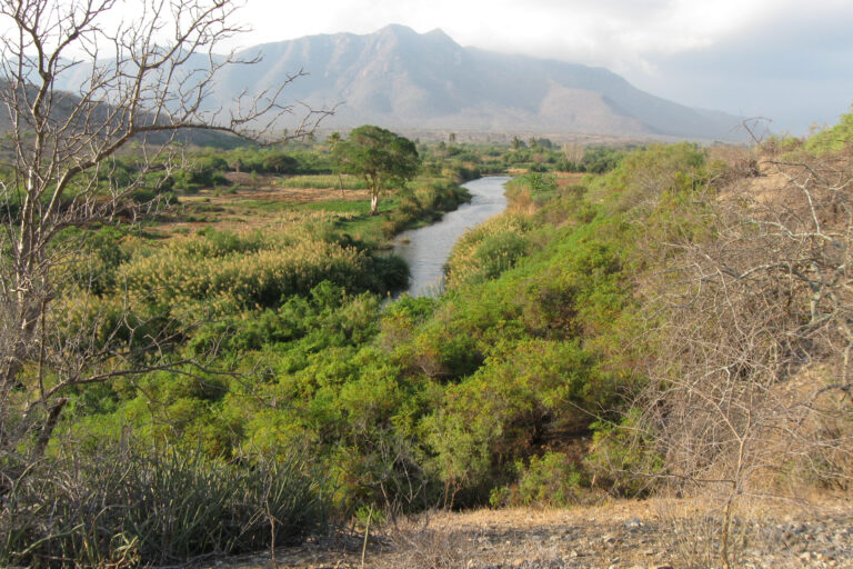
The Mkomazi Water Basin in North East Tanzania (Kilimanjaro Region) covers the eastern flank of the Pare Mountains, the northern side of the Usambara Mountains and the valley of Mkomazi River. Agriculture is the major economic sector in the area. Particularly in the montane forest zone and on the floodplains along Mkomazi River conditions for rainfed and irrigated farming are excellent (high water availability, fertile soils), whereas the savanna vegetation on the mountain slopes and at the valley bottom feeds pasturing livestock. As in other fertile mountainous regions on the African continent, the intensity of land use activities and the consumption of land in the Mkomazi Water Basin are rapidly growing. This leads to direct loss of valuable unique ecosystems, such as montane cloud forests, and to increasing exploitation of natural resources, particularly water. Additionally, locally rising temperatures and reduced rainfall reliability as consequences of global climate change confine water availability and increase stress on local ecosystems.
Ecosystem degradation and loss can already be observed in the Mkomazi Water Basin, for instance in the South Pare Mountains, where pristine cloud forests are diminishing at high pace. This development is expected to have serious negative impacts on the future availability of ecosystem services in the Mkomazi Water Basin. For example, the cloud forests are crucial sources of rainfall in the region and their loss would cause extreme changes in water availability and therefore threaten agricultural production.
The aims of this study were to investigate the effects of various environmental factors on the distribution of land use and land cover (LULC) types in Mkomazi Water Basin as well as on the functional composition of local plant communities. Moreover, the influences of LULC types and of the functional composition of plant communities on crucial ecosystem properties and processes, such as primary production, was of interest. Finally, the objective was to evaluate the vulnerability of different eco- and agrosystems to land use intensification and climate change and to predict potential effects on the future availability of ecosystem services in Mkomazi Water Basin.
Recording of environmental parameters and plant functional traits on 150 plots
The study was conducted in the central Mkomazi Water Basin covering the eastern side of the South Pare Mountains, the northern edge of the Usambara Mountains and the section of the Mkomazi River Valley between Gonja in the North and Lake Manka in the South (totaling about 1.100 km²). 150 sampling plots were distributed over the study area covering all relevant LULC types. In each sampling plot topography, land use activities and their effects on vegetation structure and soils, information about other disturbances such as fires and erosion, vegetation structure, soil parameters and functional traits of the most dominant plant species were recorded. Local climatic data were obtained from a hydrological model by Dr. Godfrey Mmbando. All data were collected between October 2011 and December 2012. The field work was substantially supported by Abdallah Mpogole as well as by local residents of the Mkomazi Water Basin.
Land cover distribution along environmental gradients
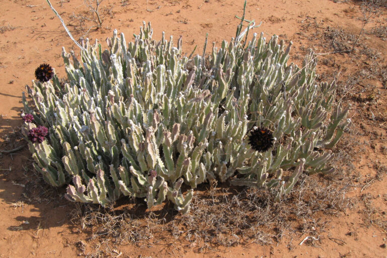
Mkomazi Water Basin can be divided into three ecological zones with significant differences in climatic conditions and predominant land cover. These are (1) the highlands (> 1,200 m asl) with evergreen highland forests, plantation forests, homegardens and fallow grass- and shrublands, (2) the slopes (> 600 m to 1,200 m asl) with deciduous shrub- and woodlands, riparian woodlands along streams, irrigated terrace farms and rain-fed farms as well as (3) the lowlands (up to 600 m asl) with tree and bush savanna, temporary flooded reeds, grasslands and paddy rice fields.
Even though climatic factors were identified as relevant drivers of land cover distribution in the central Mkomazi Water Basin, the most important determinant was disturbance intensity. Therefore, analyses of landscape change in areas with widespread agricultural land use should avoid to focus exclusively on pristine nature and instead include cultivated land. Otherwise, the relevance of disturbances as drivers of change could be underestimated.
Evergreen highland forests and homegardens were identified as the most vulnerable land cover units to changing climate and increasing land use intensity in the study area. This is of concern for the entire Mkomazi Water Basin since degradation and loss of these ecosystems could trigger significant changes of the hydrological regime resulting in reduced water availability on the slopes and in the lowlands.
Environmental factors and plant functional traits as determinants of ecosystem properties
This part of the study assessed how different ecosystem properties (here net primary productivity, litter thickness and erosion intensity) in Mkomazi Water Basin respond to environmental factors and plant functional traits.
All three ecosystem properties were best explained by combined effects of environmental factors and plant functional traits. Net primary productivity was negatively affected by aridity, grazing and plant investment in spinescence and positively by variation in plant height. Litter thickness was determined by negative effects of disturbance, grazing and spinescence. Erosion intensity increased with topography and decreased with the abundance of phanerophyts.
It can be concluded that ecosystem properties in diverse landscapes are determined by mixed abiotic and biotic effects. Furthermore, the biotic effects on ecosystem properties are dominated by the leaf economics spectrum and the plant size axis. In order to assess the potential effects of land use intensification and climate change on ecosystem properties and the related ecosystem services a sound understanding of the major determinants of ecosystem properties is required.
Direct environmental vs. functional trait-mediated effects on primary productivity
Finally, the collected data of environmental factors, plant functional traits and net primary productivity were evaluated through a path analysis to simultaneously analyze plant functional trait response and effect. This allowed conclusions about the relevance of direct environmental effects on primary productivity compared to effects that are mediated by the properties of biotic communities.
At first, an a priori model was devised for the study area to describe expected trait response to climate, soil and disturbance simultaneously with trait effects on primary productivity. The path analysis was applied to three different data sets: data from all plots over the entire basin, data from plots in the lowlands and data from plots in the highlands.
The resulting models revealed that in areas with long environmental gradients (high variation in environmental conditions) direct environmental effects on primary productivity outweigh indirect, trait-mediated effects whereas in areas with short environmental gradients (low variation in environmental conditions) trait-mediated effects gain more relevance.